1994-1995
Archaeological Investigations at Phu Noi – A Late Prehistoric Village
Phu Noi (15°14’20.33″N, 100°35’0.82″E): archaeological site (ca. 48 km NW from Tha Kae) located in Ban Mi district, an old town established by Phuan people (migrated from Laos around 1870 ca.) (Fig. 1) and named after their typical hand weaving method to weave cotton and silk fabric (Mat Mi) (Fig. 2). The area is characterized by low hills that Natapintu defined the ‘Takli Undulating Terrains’.
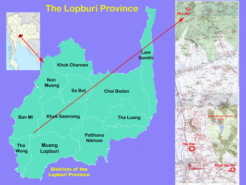
Fig. 1 – Lopburi Province (left) showing the Ban Mi district and (right) the location of Phu Noi archaeological site.
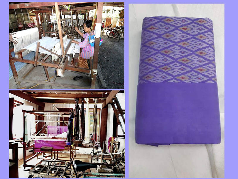
Fig. 2 – Matmi-type silk fabric (right), woven with traditional pedal looms in the village of Ban Kluai (Ban Mi Dist.).
In 1983, the foundation works for a masonry open pavillon (Sala Thai) at the Buddhist temple of the village (Wat Phu Noi) (Fig. 3), discovered human skeletal remains and ceramic pots; in 1984 followed a rescue excavation conducted by Surapol Natapintu. The 3 x 2 m dig unearthed 32 graves -stuck in three mortuary phases- accompanied by ceramic pots, and personal ornaments of shell, tortoise shell, ivory and stone. In 1994 Natapintu, co-director of LoRAP, drew our attention to this site, which could have represented a single cultural phase perhaps related to the spread of agriculture in the Lopburi region. The site was just what we were looking for at that time, but in archeology what we expect is not always fulfilled.
In fact, our stratigraphic excavation discovered that the archaeological deposit -from 30 to 250 cm thick- consisted of a lower layer with several mortuary phases datable between the late Bronze Age and the middle Iron Age (600 BCE-200/300 CE), and of a top layer of the late Iron Age/proto-Dvaravati Period (3rd/4th-6th cent CE) with remains of habitation and living activities.
The site (less than 5 ha) is located on a relatively wide terrace that gently slopes from east to west where the Phu Noi creek marks the eastern limit of the terrace (Fig. 4).
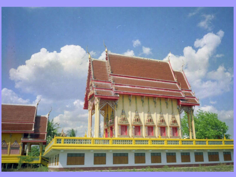
Fig. 3 – Phu Noi, the Sala Thai built on the 1990 Thai FAD rescue excavation.
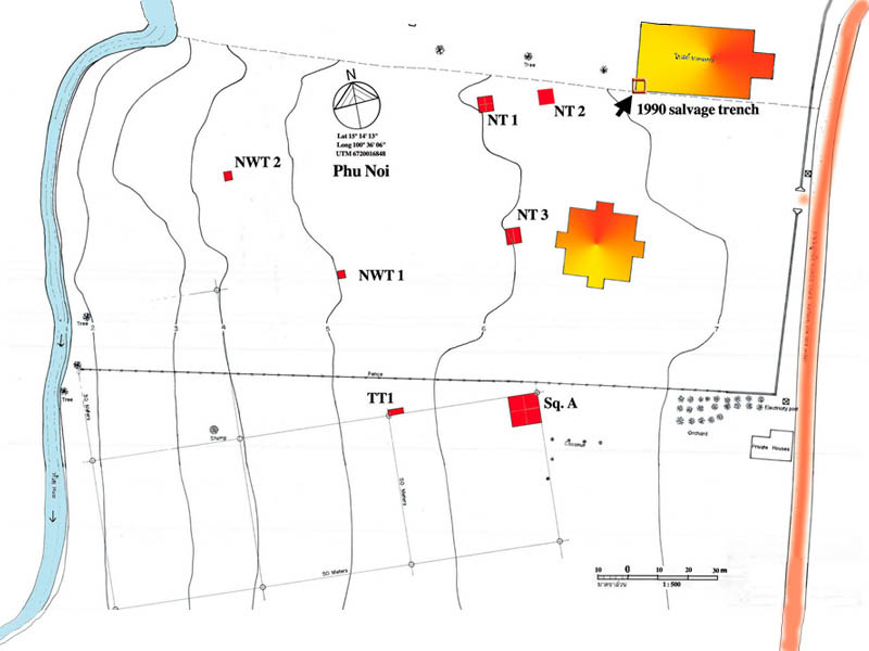
Fig. 4 – Plan of the LoRAP excavation units at Phu Noi: Sq. A = Square A; NT1, NT2, NT3 = North Trenches 1-3; NWT1, NWT2 = North-west Trenches 1-2; TT1 = Test Trench 1.
We set up four excavation units along a South-North axis (Sq. A, NT1, NT2, NT3) in the flat part of the terrace; several test-trenches were excavated along the sloping terrain towards the creek. Any archaeological evidence was found in the test-trenches, while a wide cemetery of single extended burials in vertical pits was found in the four South-North excavation units.
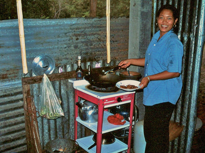
Fig. 5 – Our camp kitchen with Phoo, housekeeper and wonderful cook!
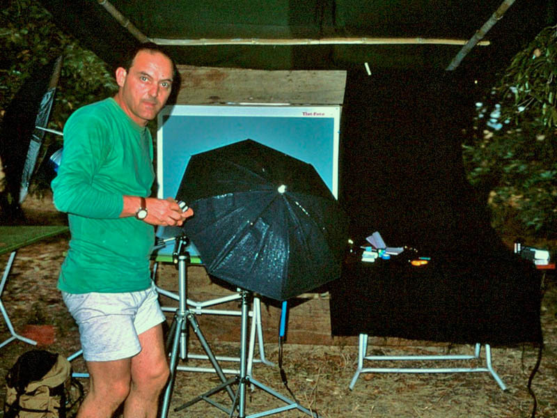
Fig. 6 – The field photo lab with our dear friend Gino Biagiotti, no longer with us.
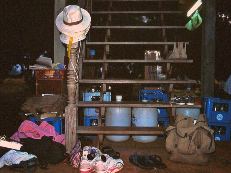
Fig. 7 – Late evening: shoes, hats, backpacks on the stairs of the house … everything is ready for the next early morning awakening.
The Early Graveyard
In the southernmost trench (Square A) a single mortuary level was found under the very dark, clayey top soil (30–50 cm thick on average). Although still in their original anatomical position, the skeletal remains were very fragmented and/or partly missing, due to the acidic nature of the soil, to natural disturbances and to the weight of modern tractors (Fig. 8).
In the remaining three excavation trenches (Northern Trench 1-3) the cemetery consisted of inhumations either superimposed, or crossing, or aligned. In the superimposed graves just a few centimetres separate one burial from the one beneath, with the grave goods crushed and splayed inside the pits (Fig. 9). The graves (mostly NE-SW or NW-SE oriented) were clustered in groups often bordering clusters of post-holes (Fig. 10).
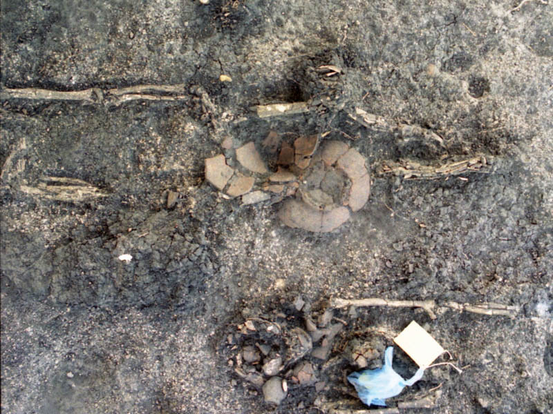
Fig. 8 – Sq. A, Burial 6 (B.6). Although in anatomical connection, the bones were very fragmented due to the acidic soil and the weight of modern tractors.
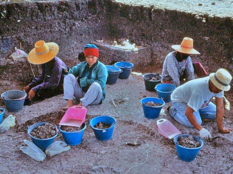
Fig. 9 – NT1, our workers intent on digging with trowels the archaeological deposit near the burials.
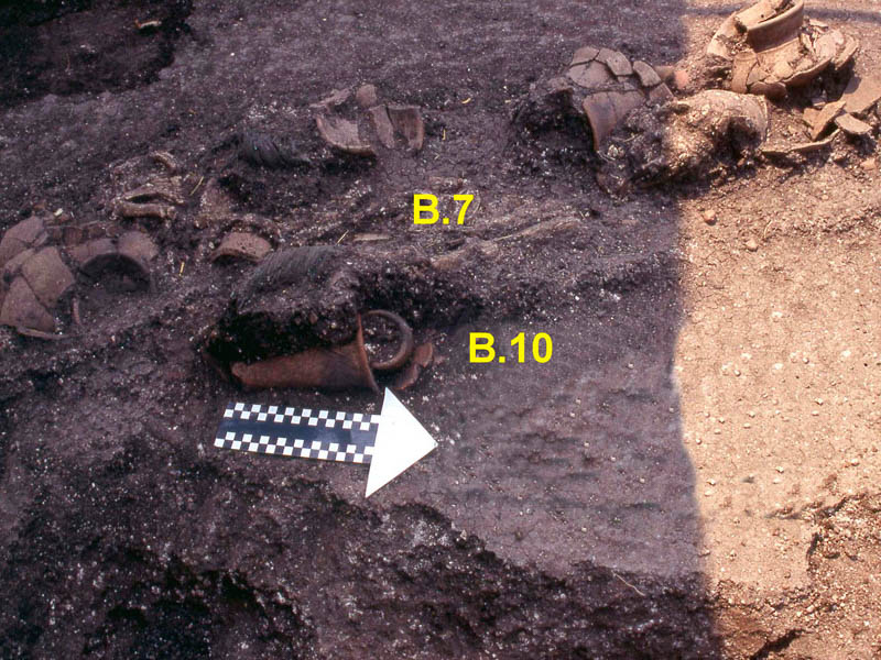
Fig. 10 – NT 3. The B.7 and B.10 closely overlapped, with the funerary vases broken but still in situ.
Having aligned the excavation trenches at varying distance one from the other, we noticed a progressive concentration of burials towards the northern area of the site:
- one mortuary level in Sq. A;
- two mortuary levels in NT1 and NT3,
- three in NT2, as it was in the 1984 Thai FAD salvage excavation.
This “stratigraphy” was probably due to the ancient morphology of the terrace, whose sloping side cut by fan-shaped gullies offered a relatively soft and thick soil that gradually tapers towards the east on the flat part of the terrace (Fig.s 11-12).
The availability of thicker soil in the gullies might have influenced the utilitarian choice of the terrain for the relatively deep interments. However, we cannot rule out an ideological variable, as the clustered graves also hint at the deliberate reuse of the same lots by the same kin groups. The arrangement of the burials near or around clusters of post-holes (ritual elevated structures or ritual enclosures?) might be further evidence of the mature rituality of the agricultural communities settled in the rich habitat of the undulating terrains overlooking the Lopburi Plain between the 1st millennium BCE and the first half of the 1st millennium CE.
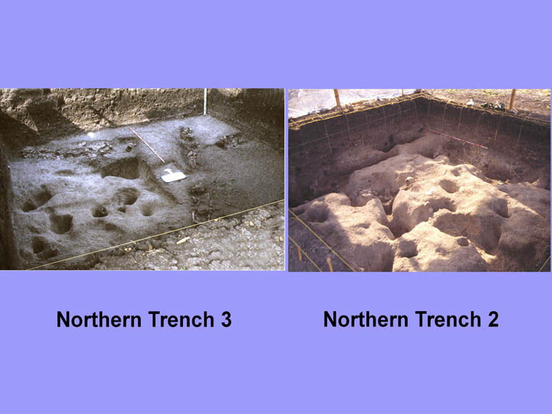
Fig. 11 – NT3 and NT2: view of the graves in groups or aligned, and often delimited by post holes.
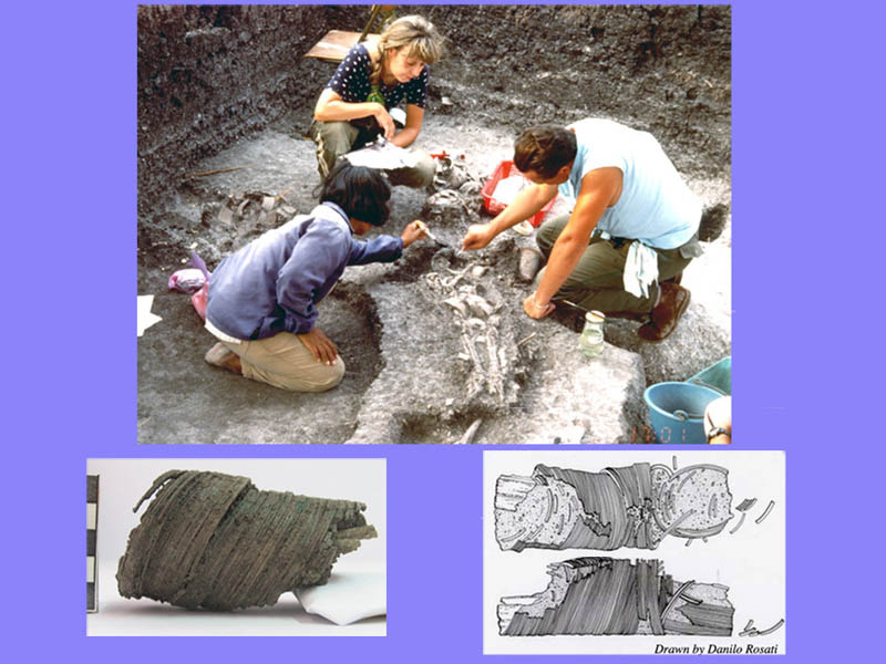
Fig. 12 – NT3: the Iron Age B.7 under excavation; (below) the multi-circle bronze bracelets worn on the forearms of the adult male.
Also the grave goods accompanying the dead, adorned with stone, shell or bronze jewels, were arranged ritually: ceramic vessels near the head and/or between the legs, animal offerings near the legs. A number of chronological “markers” are present in the graves: particularly noteworthy are two tin-bronze armlets, each composed of a hundred very thin separate rings, on the wrists of the inhumed in Burial 7 (NT3) (see Fig. 10).
Recurrent burial items are small dish on high, truncated-cone pedestal, globular Hole Mouth Jars (HMJ) (similar to the Buddhist ‘Alms bowls’) with or without a short, flaring pedestal, usually decorated with a band of Thick Red Burnished Slip (TRBS) under the lip and on the shoulder, as well as the animal offerings (pig or deer limbs), the terracotta spindle-whorls, as well as shell and stone jewellery (Fig. 13).
Noticeable the inhumation of a single individual (B4-NT3) accompanied by several, crashed vessels (Fig. 14). Once reassembled, the potshards formed eleven vessels, including three small jars, two dishes-on-stand, one pedestalled bowl and an exceptional set formed by a ‘Hole-mouth jar’ associated to a large pear-shaped pot with a very wide mouth and a much smaller hole at the bottom. We tend to regard these vases, arranged one on top of the other, as a cooking device, possibly for steaming, the first one of this kind found so far in Central Thailand (Fig. 15).
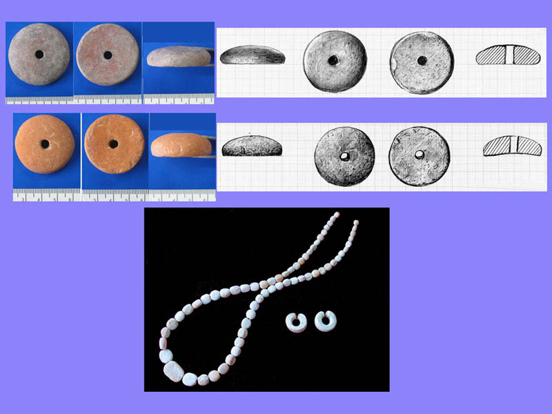
Fig. 13 – NT2: (above) terracotta spindlewhorls from various burials; (below) shell beads necklace from the B.13, and shell earrings from the B.6.
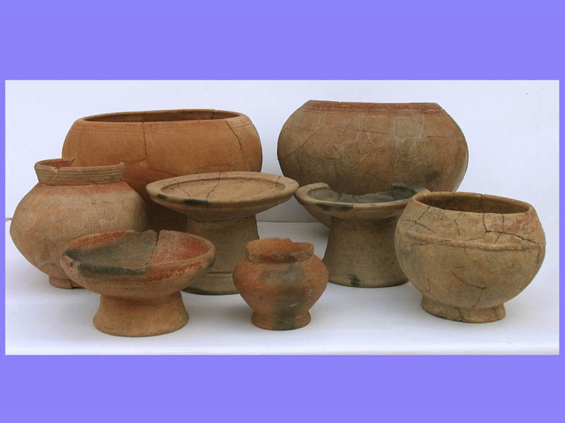
Fig. 14 – NT3: part of the restored vases placed in the grave goods of B.4.
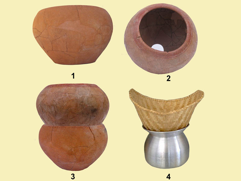
Fig. 15 – NT3, B.4. (1-2) “Hole-mouth jars”, one of which has a hole in the bottom; when stacked they probably served as a steamer (3), like a popular modern type (4).
Relevant to the understanding of the socio-economic growth of this small and peripheral community during the Iron Age, is the finding of terracotta spindle whorls that testify to the development of spinning-weaving activities, probably a family run handicraft.
Few items might have been distinctive of gender differentiation: at a preliminary analysis, it seems that the spindle whorls are not present in the graves where shell-made small axe/adzes are present.
Layer 2b: The Transition to the Upper Level
The earliest cultural level is separated from the later occupation by a calcium carbonate crust (ca. 3 cm thick); this is a natural formation favoured by poor vegetation cover, probably in a period of abandonment of the site.
Layer 2a: The Iron Age/proto-Dvaravati Occupation
Clusters of potshards hint at the disturbance of the older graves in the final occupation of the site, evidenced by activity areas with splinters of faunas, antler/bone artefacts (finished and unfinished), broken limestone axes, and fragments of terracotta artefacts (e.g. ear-studs, spindle whorls, skin-rubbers) and of technical ceramics associated with corroded bronze lumps. Although very few, these latter findings are of extraordinary relevance, as evidence copper-base metallurgy carried out at village level by not-specialized communities (Fig.s 16-17).
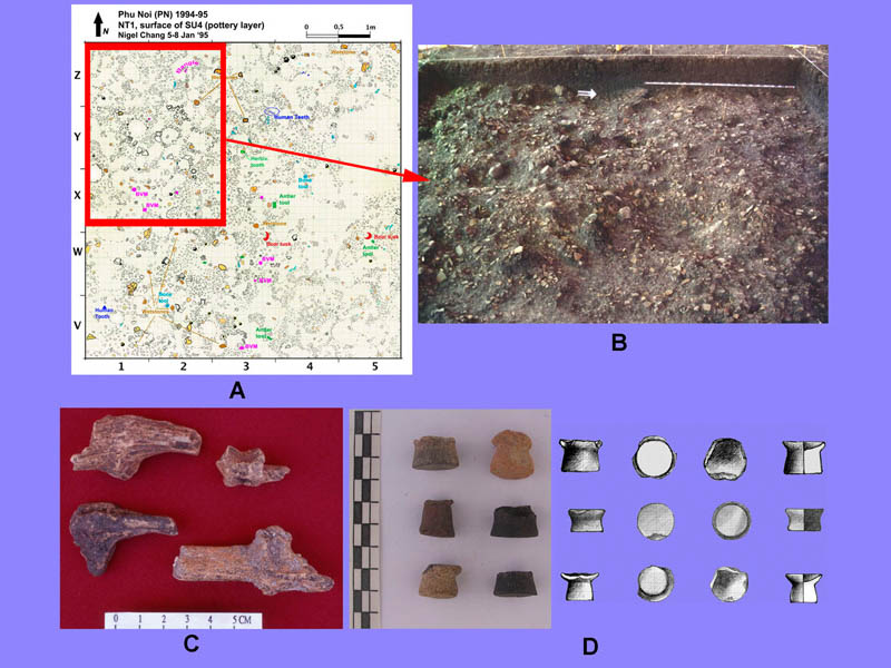
Fig. 16 – NT1 proto-Dvaravati occupation. A) the 1:1 plan documents the distribution of the fragmented artifacts (B); C) antler tools; D) fragments of terracotta ear-studs.

Fig. 17 – After the excavation (6 a.m.-2 p.m.) and a nap, back to the field to draw the plans of the layers and tombs excavated.
“Exotic” goods such as the skin-rubbers and ear-studs of Indian style in a small and peripheral rural community takes considerable importance as they signal the localization of exogenous ritual practices of personal hygiene (the skin-rubbers), and the idea to represent beauty and/or status through ‘exotic’ ornaments of simple earthenware (the ear-studs) during the formative proto-Dvaravati period.